Focus on HYCOS project
- News
Project summary
Developing an innovative method of monitoring the coastal erosion using the hybridation of three data sources: LiDAR, photogrammetry, satellite. The project will last 10 months.
Partners
GEOSAT is a group of 140 people involved in all domains related to 3D/ 4D measurement: underground network detections, 3D scanning and modelling, Mobile Mapping, Land Surveying. (www.geo-sat.com)
GeoNumerics provides consultancy services, markets software components and conducts research-and-development (R&D) projects in the field of high precision navigation and kinematic surveying, especially focusing on sensor orientation and calibration, and trajectory determination. (www.geonumerics.es)
Kick-off meeting held in Bordeaux on January 25th with the GeoNumerics, GEOSAT and Telespazio (third partner). Minutes of the meeting:
- Structure of the project
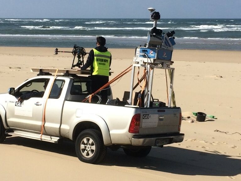
- Ground System by GEOSAT
- MapKITE : Tandem air-and-ground 3D Mapping
- Needs and challenges of MapKITE in Hycos
- Satellite Imagery by Telespazio
- Outcome of Hycos
- Links with local authorities and continuation in 2019
- Test plan (March 2018)
First campaign – Cap Ferret (France) March 21st and 22nd

TEST1 took place in the south-most part of Cap Ferret (see next slides for details). The selection of this place is the result of considering:
- Relevance of the area in terms of impact of coastal erosion to society
- Suitability in terms of scientific requirements
- Ease of access
The selection of this week is the results of crossing:
- Project schedule & Consortium preferences
- Satellite imagery favourable conditions
- Low tide happens around mid day.
- Tuesday, 20th: actual Sentinel2A imagery + (Monday pre-test, Tuesday actual flights)
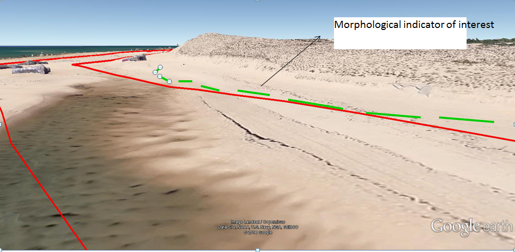
Goal: capture the breakline of the dune (definition of “coast”)
- Height difference beach-top of dune = 10m – 16m
- MMS will capture the beach and “façade” of the dune; drone will complement with top of dune and satellite