Supported projects in environment
Environment is understood as all topics dealing with sustainable protection, monitoring and exploitation of marine natural resources and coastal areas.
ABECE
Partners Terraspatium (Greece) & ITTI (Poland)
The Anticipation of Blue Economy Cascading Effects (ABECE) project will deliver a simulation tool for cross-sectoral cascading effects identification and prediction in regards to environmental and coastal hazards. The proposed solution will enable decision makers related to Blue Economy (e.g. mayors of coastal towns which economy rely on tourism, harbours and marinas operators, SAR units, etc.) to predict severe environmental disruptions and their non-obvious consequences of disruptions to various areas of Blue Economy like tourism, societal functioning, logistics, critical infrastructure functioning, etc.
The project will be built upon an IT solution for cascading effects prediction in crisis management. The solution is based on three pillars which will be adjusted during the project to the requirements of the environment and coastal hazards in the area of Blue Economy. Those pillars are: (i) Simulation Engine for Critical Infrastructure dependencies computation, (ii) Scenario Editor for variables’ and dependencies’ modelling, and (iii) Scenario Player for cascading effects and crisis evolution visualization along with real-time interactions with user. These three pillars are integrated in a complete what-if decision support system, able to simulate the possible consequences of a decision before it is really made. In particular the ITTI’s solution is focused on discovery of “missing branches” in possible future course of events tree, which are overlooked by experts, because they are concern knowledge from multiple domains which is rarely possessed by any expert simultaneously. In order to fulfil all of the project’s objectives the consortium consists of two SMEs, along with a Polish Innovation Actor (The Main School of Fire Service). The capabilities of the partners cover all of the aspects in order to fully comply with the defined objectives and requirements of the project and Blue Economy sector.
AMOS
Partners: SEMANTIC TS (France) and GET (Greece)
The project aim is to develop a platform that will provide information about seabed (seafloor classification and bathymetry) as well as information about fishery resources using the SEMANTIC TS eBeem single beam acoustic system and the spatial data infrastructure provided by GET. The system will target sea shallow water (ranging from a few decimeters depth from 40 to 80m, depending on the use) but it could also be used in inland waters like rivers, lakes, and ponds. The SEMANTIC TS eBeem system is a brand new single beam acoustic system that can be used easily from a boat, coupled with a cloud platform to process the data. Using this system, the users can easily perform the measurements; upload the data to the cloud for further analysis and for the production of the final products and datasets. The objectives are:
- To address new areas (hazardous areas, lakes, rivers, unnavigable zones) and improve significantly the monitoring coverage, by porting the system on a drone (USV). Some areas cannot be reached by a boat (both for safety and practical reasons) and the possibility to use a small USV embedding the eBeem system will increase the business opportunities.
- To improve the platforms (GET and SEMANTIC TS) and to enable interaction, survey requests and data extraction.
Coupling the two platforms, a comprehensive catalog of environmental data on both the Greek and the French market would be available. To the currently available spatial data, bathymetry, temperature and seabed classification data from reliable in-situ measurements will be added. The data will be included to the spatial data infrastructure which will be developed by GET. The system will be able to visualize the data in forms of web maps, and at the same time, to provide access to additional related data and information available in other open data sources, like the Marine Copernicus System (information about sea surface temperature, chlorophyll, water color etc.) or EEA (information about inland waters, water quality measurements etc.) as well as access to Sentinel satellite images using the GET OpenData Service.
Partners: ACRI-HE (France) and Planetek Hellas (Greece)
During the last few years, a significant number of projects were carried out to promote the use of the Earth Observation (EO) by satellite to the benefit of aquaculture and fisheries sectors (ACRI and Planetek Hellas have a long past of successful collaboration on exploitation of EO). The EU funded SAFI project has been the opportunity to establish deep relationship with aquaculture professionals and to a better level understanding of their requirements about environmental monitoring. A service has been put in place to supply aquaculture professional with EO derived data. EO can regularly provide synoptic and useful information on the environment (Harmful Algal Blooms or HABs, thermal fronts, water quality) thanks to the Sentinel Programme of Copernicus. However, its standalone use is limited as key parameters like local current speed and direction are not retrievable from space. In addition, the spatial coverage of the imagery might be impacted by clouds presence or its quality affected by sun specular reflection. To expand the SAFI offer to a new level of service, we propose to combine EO data and coastal hydrodynamic modeling. This will be demonstrated over two sites (one in France and one in Greece) and will allow to get access to current fields to complement diagnostic for farms deployment (Where to put cages with an optimal water circulation? Are the farms vulnerable in case of external pollution? Where are dispersed the farms effluents? Etc.) And to offer prognostic on environmental issues (if a HAB or a surface pollution is detected, where will it drift in the next coming hours/days?). Two associations of aquaculture farmers participate in the project; The objective is to pursue the dialogue established in SAFI and SAIMON and to expand the offer to new parameters and new services that would be easy to deploy on any site.
Copernicus Programme is providing operationally modelled currents data for all European regional seas and also at the global level. Thanks to the development of a generic interface with local modelling, we believe that there is real business opportunity in the context of expanding aquaculture and blue growth. The project will allow for ACRI and Planetek Hellas to gain competitiveness on i) efficient deployment of local hydrodynamic model and on ii) accessing Copernicus data to force the local modeling. It will also consolidate and expand the portfolio of services that was set up in SAFI.
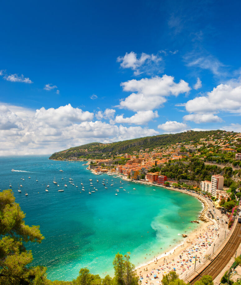
INTEGRATED COASTAL MONITORING
Partners: Vultus AB and 4IT AB (Sweden)
There is a common European need to assess and monitor the present quality status of water bodies. The aim with the project is to develop a novel prototype for decision support to environmental monitoring with remotely sensed data, data acquisition and processing systems to assess conditions and forecast trends. The project was applied by two Swedish SMEs; Vultus and 4ITAB. Vultus works with computer vision and spectral analysis in agriculture. The core competencies within Vultus are mathematical modelling, computer vision, machine learning and extensive drone knowledge. 4IT create decision support systems for transport and energy agencies. They have extensive knowledge about decision support systems, complex database structures, web-development and data visualization.
NEURAMARIS
Partners: Neuro-SYS and CYPREOS France Eponge (France)
The NEPTUNE programme is the initiation step of a wider four years collaborative European project called NEURALARIS that will be submitted end 2017. The main objectives of this wide project are: 1. the development of innovative sampling techniques respectful with the bioavailability and chemical integrity preservation of marine organisms (marine sponges); 2. The development of new treatments against neurodegenerative diseases ( Alzheimer’s, Parkinson’s, Huntington’s and Lou Gehrig’s diseases) using hi-end in vitro modelling studies based on green-extracts of marine sponges. The final goals of the NEURAMARIS project are:
- Patenting and licensing innovating sampling techniques adaptable to many marine organisms and capable to keep their integrity from the sampling to the conservation.
- Patenting and licensing new molecules and synergistic effects identify and assessed by the project.
- Selling of nutraceuticals based on the marine sponge extracts stemmed from the project. As a preliminary validation stage, Neuro-Sys fully realised early 2017 an analytic and pharmacological feasibility study based on two marine sponge species.
One (coded NSE-1) actually revealed a very interesting in vitro neuroprotective profile for Alzheimer’s disease. These positive results encouraged Neuro-Sys to setup the collaborative European project. The NEPTUNE part of the project is to assess on the efficiency of 10 (necessary minimum evidence) marine sponge species selected by the Neuro-Sys’scientific board for their promising composition. A special focus on the NSE-1 will be made as further work need to be realised under the NEPTUNE project to push forward the investigations and to validate the processes.
TRITON
Partners: COMEX SA (France) and Zero 2 Infinity SL (Spain)
The project will prove by demonstration that high stratospheric balloons can be used as an alternative to satellite imagery for the observation of specific areas in the sea. Satellite data is used today in various fields of Earth and ocean observation. The costs however of such systems are high, while their temporal and spatial resolution is rather low. Rocket launches of satellites also have a significant impact on the environment and are restricted to countries that have the financial capacity to pay for such systems.
Stratospheric balloons are an alternative for observation and are accessible to all countries and entities in the Mediterranean basin. However, those balloons have a certain drawback in the fact that they are passive; Their trajectory completely depends on the winds (low and high altitude) during a specific mission. TRITON intends to service multiple markets by launching balloons from the sea instead of land to Near Space. Launching stratospheric balloons from international waters will reduce the administrative restrictions of such launches and also allows to compensate low altitude winds. The proposed project aims to demonstrate that, through precise trajectory predictions we are able to observe, over time, a specific zone of interest. Such zone could be the place where an oil spill was discovered in order to monitor its evolution. It could also be a zone of intense maritime traffic or where refugees’ boats are expected. The proposed project will demonstrate a novel, versatile and cost effective solution for fast response needs for monitoring specific maritime areas. The project will be performed by two SMEs with complementing cross sectional expertise that will lead to cross border cooperation between two NEPTUNE regions (PACA and CATALUNYA). TRITON is an initiative by COMEX along with Zero2Infinity (Z2I) as its partner. COMEX an SME with decades of experience in maritime engineering and Z2I Europe's leading private company in the field of high altitude balloon launching. In TRITON a series of tests will be performed where it will be shown that a specific maritime area can be monitored over a longer duration of time with stratospheric balloons. The proposed project will open up a new, economic and ecologic earth (or ocean) observation service to Europe.
World BioCoast
Partners: Terra Spatium (Greece) and I-Sea (France)
This 15-month project is implemented by a Franco-Greek consortium gathering the French SME I-Sea, located in Nouvelle-Aquitaine and specialized in earth observation and in situ monitoring with a range of products for the water and coastal environments. While the Greek SME, TerraSpatium is from Attica and has more than 25 years of focused experience and wide range of capabilities in the fields of Geo-information. The World-Biocoast project aims at the improvement of satellite data processing chains for the monitoring of natural coastal areas. It ambitions to elaborate habitat maps addressing regulatory typologies (Natura 2000) in order to help managers to draft and evaluate the impact of their own management plans. World-BioCoast will therefore be a major tool contributing to the preservation of some of the richest and most fragile environments in the world.
CBAS
Partner: I-SEA (France)
Widely distributed around the globe, cyanobacteria grows in marine and fresh waters in colonies large enough to be seen from space. The association of toxicity with such blooms frequently leads to the closure of recreational waters when blooms happen. Potential toxic effects first affect invertebrates and fishes. Extensive blooms impact plants and benthic algae due to shading. They may also induce anoxic conditions in lakes when accumulation of organic material in sediments occur inducing increased bacterial activity. Considering the combination of these adverse impacts on aquatic systems that may in turn affect various economic sectors and develop major public health issues, the development of large scale monitoring tool of cyanobacterial blooms (in particular of toxic species) is expected to benefit local population, tourism, and aquaculture. The Cyanobacteria Bloom Alert Service (CBAS) project, led by N7 Mobile (a Polish SME specialized in software development) and I-SEA (a French SME specialized in aquatic environment surveillance from space), aims at the development of the technology and infrastructure to provide a comprehensive cyanobacteria alert and monitoring system in Poland. Based on satellite images of the Copernicus constellation, CBAS will deliver near real time (NRT) information about cyanobacterial water blooms in coastal waters and lakes of Kaszuby district. The end-users of the system (public institutions and general public) will receive the information about possible harmful cyanobacterial blooms within minutes after the detection alongside with the estimated confidence level and relevant satellite images. Our surveillance solution is based on space imagery and field measurements. Observations will be translated into high addedvalue information, such as bloom location and intensity. Diffusion of the information through a Mobile Application will be developed. The application itself is innovative since it relies on the delivery of NRT observations and analysis of cyanobacterial blooms. Pioneering algorithms will be searched for to produce cyanobacteria concentration in freshwater and innovative product analysis will be also performed in order to infer alert from collected data, with indicators adapted to the needs of final end-users. CBAS opens several development opportunities such as the evaluation of the water toxicity and the prediction of bloom developments based on biophysical models. The sum of these perspectives offers excellent future prospects.
HYCOS
Partner GGEOSAT (France)
Coastal areas are complex environments hosting huge economic activity (fishing, agriculture and aquaculture, recreation, tourism, energy, transport) as well as billions of human beings (over one third of Earth population lives within 100 km of oceanic coast). Yet, coastal degradation, recently boosted by global warming, is threatening Blue Growth and pubic/private liability and safety. The goal of HYCOS is to establish a service for monitoring, accurately and frequently, the evolution of the coastline based on a cross-sectorial approach: the combination of free satellite imagery data with topographic LiDAR (laser detection and ranging) surveys with Mobile Mapping Systems (MMS) and drone-based aerial photogrammetry. These three mapping techniques are versatile (available satellites, MMS mounted on quad, and easy-to-operate drones) and together they enable surveys to be carried out at least twice a year in order to analyse physical phenomenon related to seasonal changes as well as the impacts of sporadic, high-intensity storms. The proposed multi-resolution imaging approach will produce accurate 3D geo-spatial data of the monitored coast, at a high resolution (drone imagery reaches millimetre-level ground resolution), high density (LiDAR reach around one million of measurements per second) and with large coverage (satellite imagery covers hundreds of kilometres of terrain footprint per image). Currently, coastline monitoring is carried out at a very low rate (once a year), limited to well-defined coastal areas and based on sub-optimal techniques (measurements are carried out using only static GPS technology and covering large distances on foot). HYCOS will enable dynamic, mobile land measurement (as opposed to static, tedious current pedestrian approaches) maintaining high accuracy levels provided by current MMS systems (few centimetres of error in 3D terrain models), and it will enable high reactivity by decision-makers (land authorities) thanks to its speed of implementation, both in geo-data acquisition and processing. The HYCOS demonstrator will be demonstrated in test campaigns in the area of Cap Ferret, a popular French coastal area, located between the Atlantic Ocean and the Bay of Arcachon, in which natural erosion combined with the severe winter storms in recent years has made the site particularly unstable and dangerous. More specifically, at least two campaigns will be executed to analyse the evolution of the area in a yearly-cyclic manner.
BEACH LIVE SERVICES
Partner: ADU Expertise (France)
Collecting data using a proprietary DRONE technology, with the possibility of adapting different image sensors (RGB, multispectral, thermal) in order to provide information in two areas:
- Topographic surface and volume: for example, variation of the coastline, surface with algae...
- Counting: for example, people on the beach, boats, sun umbrellas….
A flight would be carried out for the taking images that will be uploaded to a server where they will be processed to obtain the desired information after analysis; the user accedes to the platform and it would monitor the data immediately and it could take certain actions: to adjust the number of resources, to dimension the public services (bathrooms, cabins, etc.).
Our project is aimed at the creation of a new service, which allows us to offer information to our customers about different parameters related with the coast and depending on the type of service, to offer this information.
A fast, flexible and up-to-date information that allows you to have the data on particular day, to keep track of the evolution of monitored parameters in days, weeks, months, or years.
Information that reaches the customer through a simple computer platform.
In summary, we create a consortium with 3 actors:
- SQAdrones S.L., expert in Drone technology and processing of topographic and terrain information
- Dinycon Sistemas S.L.: expert in systems of counting and control of capacity, information processing and development of APPs
- ADU EXPERTISE: Start-up of Pilots, training and services of aerial works with airplanes and drones.
eBiopond
Partner: Algaria (Italy)
Algaria developed, together with a mayor university research centre (University of Milan), an innovative wastewater treatment technology based on photosynthetic microorganisms, through the integration of microbial fuel cells in regular raceways-like ponds: the e-BioPond® concept. The eBioPond® uses the electro-osmotic force generated by the bio-electrochemical system, to recover nutrients and oxidize organic carbon, while separating the anaerobic bacterial community from the microalgae bulk culture. This helps in obtaining high-quality microalgal biomass, as compared to state-of-the-art technology for wastewater treatment with microalgae. Within this technology, the SME is willing to investigate the creation of new value chains through the valorisation of microalgae biomass produced by recovering nutrients and carbon from wastewater treatment. Thus, the biomass produced could be valorised in different way, as biostimulants/fertilizers, pigment extraction, animal feed and bioplastics. Exploring and testing the market of the microalgae biomass will be the aim with the supports of company as reported in the letters attached.